Guest post by Amber Leahey, Scholars Portal, and Jay Brodeur, McMaster University Library
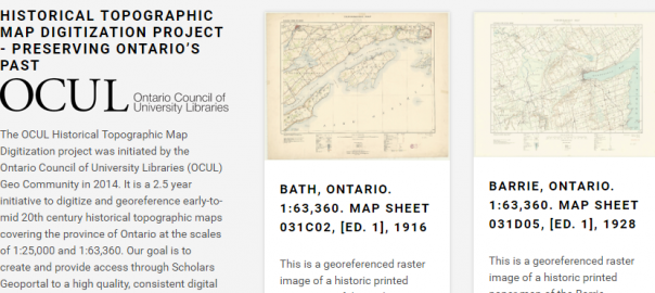
The Ontario Council of University Libraries (OCUL1) is pleased to announce the release of a shared digital collection of more than 1000 early topographic maps of Ontario, now available online!
Map libraries are really wonderful places–just ask any Librarian or staff member who provides patrons with services, guidance, and access to maps and associated cartographic material at university libraries across Ontario. Or better yet, ask the countless patrons who use the collections’ vast and varied information to support activities in their research, education, work, and private lives. Indeed, there is much to be said about sparking interest in maps and GIS by telling a story with old maps–which there are many of–at libraries across the province. With such rich and diverse map collections, and thanks to the careful curation and digitization of over 1000 early topographic maps of Ontario, academic libraries continue to play a key role in preserving our national and provincial heritage in the digital age.
Led by the OCUL Geo Community, the OCUL Historical Topographic Map Digitization Project is a province-wide collaboration to inventory, digitize, georeference, and provide broad access to early topographic maps of Ontario. The initiative represents the single most comprehensive digitization project of the early National Topographic Series (NTS) map collection in Canada. The publicly-available collection provides access to georeferenced topographic maps at the 1:25000 and 1:63360 (one inch to one mile) scales, covering towns, cities, and rural areas in Ontario over the period of 1906 to 1977. As the collective achievement of individuals representing university libraries across Ontario, this shared collection exemplifies OCUL’s continuing commitment to collaborative approaches that improve access to knowledge both within and beyond the province. The completion of this project also serves as an opportunity to reflect on the history of the OCUL Geo Community, and celebrate the shared vision and effort that have made possible the current achievement.
The significance of historical maps
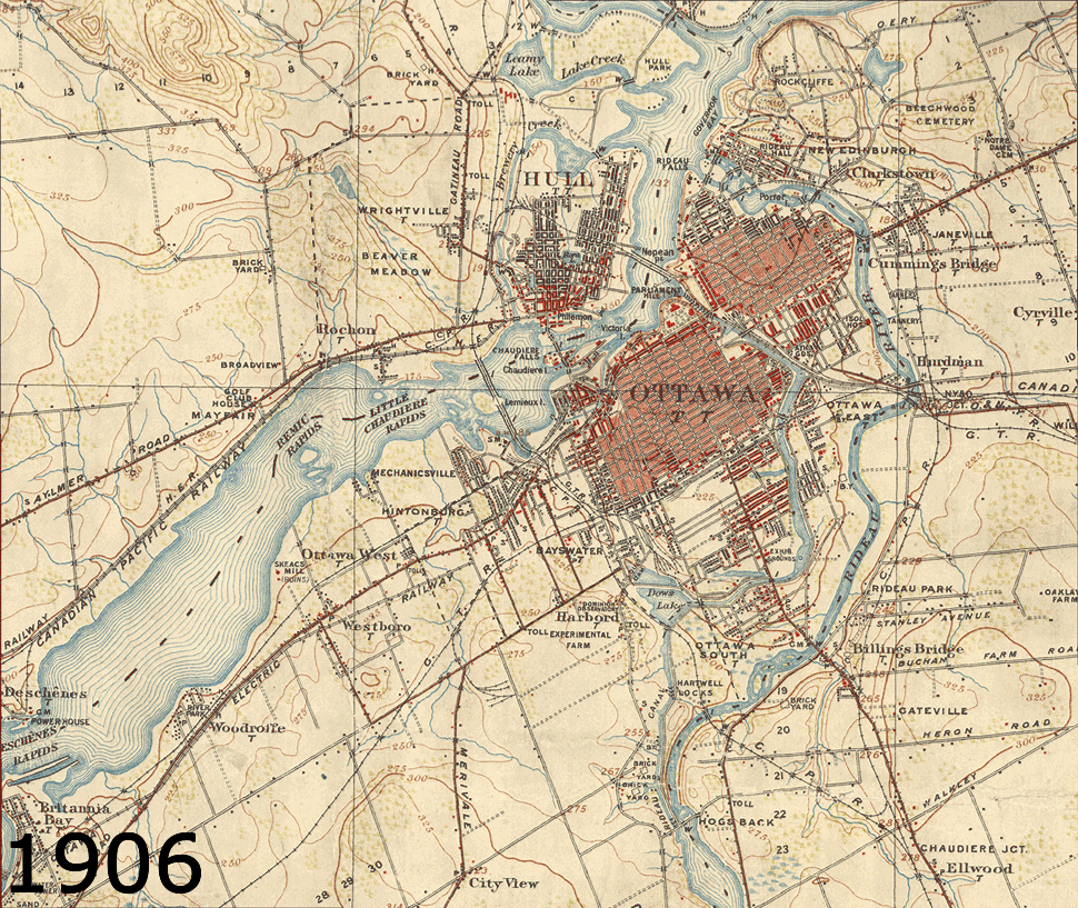
Much like a photograph, landscape painting, or textual account, a historical or otherwise superseded map preserves information from the past and provides its viewer an opportunity to explore the ways in which environments, cultures, and human knowledge have changed over time. As a part of their mission, map collections, libraries, and archives have a long tradition of preserving and providing access to a wide array of cartographic and cultural information.
In the present day, early topographic maps are a critical resource for those with an interest in historical events and exploring change over time. For many researchers, local historians, planners, conservationists, engineers, and consulting firms (to name but a few), historical topographic maps provide a unique snapshot of a given time period, showing both man-made and natural features such as spot heights, waterways, shorelines, boundaries, roads, railways, houses, barns, electricity lines, industry, agriculture, and much more.
From curation to digitization: The role of the OCUL Geo Community
Among the challenges faced in producing such a comprehensive digital collection is the effort required to inventory and bring together sheets that exist across a multitude of map libraries. Given the variety and quantity of maps that are created during any given period and the finite nature of storage space and budgets, map collection curators are required to make careful (and often difficult!) choices about the collections they develop, steward, and preserve over time. As a result, many institutions have focused their topographic map collections around items of local relevance and significance. In Ontario, for example, the maps that make up the digitized series–originally produced by the Department of National Defence (until 1923: the Department of Militia and Defence)–are dispersed across many Ontario University Libraries. Over the years, Ontario libraries have collaborated to develop a comprehensive inventory of known maps from the series in existence, working closely with the Ontario Archives and Library and Archives Canada more recently for this digitization project. That the vast majority of sheets in these collections could be found at OCUL institutions is a testament to the foundational work of the early Geo and Map Communities.
As the predecessor of the OCUL Geo Community, the OCUL Map Group (then known as the OULC Map Group) was formed in 1973 with the goal of communicating and collaborating on map-related projects. Among their completed initiatives was the creation of a union catalogue of topographic maps across institutions. The importance of this work to OCUL Geo’s current-day success shouldn’t be overlooked, as these foundational efforts provided a means for coordinating map collections across OCUL institutions, and helped ensure maximal collective coverage in a cost- and space-efficient manner. Today, the OCUL Geo Community continues the goals of its predecessor, with a commitment to fostering dialogue around important issues such as best practices for the digitization of maps in libraries, access to maps and GIS for research, and collaboration on a variety of library activities in these areas.
Moving forward, the group plans to engage with the wider map community in Canada about the project, specifically at the upcoming Association of Canadian Map Libraries and Archives Carto 2017 Conference being held in Vancouver, B.C. in June (ACMLA website). The group hopes to identify opportunities to build on the project, engaging with other university libraries and archives, to digitize maps from this national collection.
We are very excited about this release, please let us know how you may be using the maps for your next project! For more information or to get in touch with us contact the project members at topomaps@scholarsportal.info.
We hope to hear from you!
1 OCUL is a consortium of 21 University Libraries in Ontario, and fosters collaboration around library activities and services including map and GIS collections, digitization, and digital curation. Ontario’s university libraries have been working together through OCUL on initiatives such as this since 1967. In 2017, OCUL is celebrating its 50th anniversary, and this project demonstrates the ongoing success of this collaboration.}